


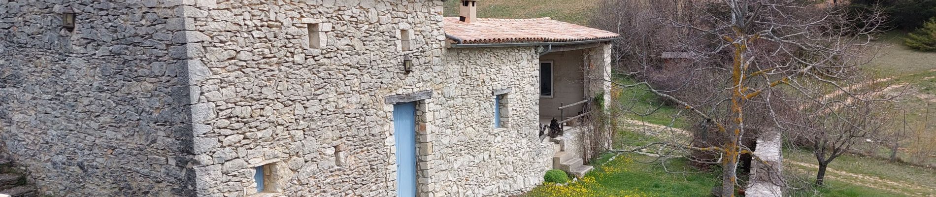
Jas de Taramate

supercolas
User GUIDE
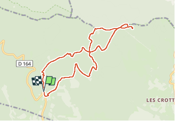

Length
9.6 km

Max alt
1307 m

Uphill gradient
376 m
Km-Effort
14.6 km

Min alt
1018 m

Downhill gradient
380 m
Boucle
Yes
Creation date :
2025-04-04 08:25:03.591
Updated on :
2025-04-04 15:32:29.506
2h20
Difficulty : Medium

FREE GPS app for hiking
 SityTrail
IGN / Geographical institutes
SityTrail Plus
The world is yours!
About
Trail Walking of 9.6 km to be discovered at Provence-Alpes-Côte d'Azur, Vaucluse, Aurel. This trail is proposed by supercolas.
Description
Ventouret Aurel
Photos


Positioning
Country:
France
Region :
Provence-Alpes-Côte d'Azur
Department/Province :
Vaucluse
Municipality :
Aurel
Location:
Unknown
Start:(Dec)
Start:(UTM)
689890 ; 4889776 (31T) N.
Comments