


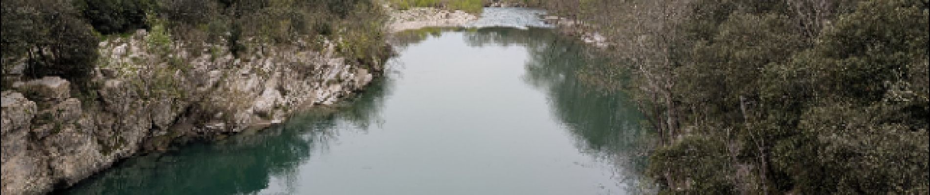
Issensac - ravin des arcs

Jean-Pierre Mourgues
User
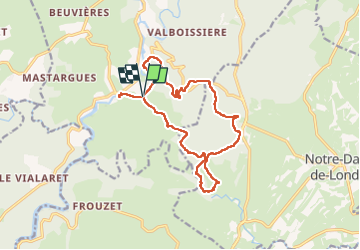

Length
16.3 km

Max alt
370 m

Uphill gradient
519 m
Km-Effort
23 km

Min alt
107 m

Downhill gradient
520 m
Boucle
Yes
Creation date :
2025-04-04 07:03:15.307
Updated on :
2025-04-04 16:32:48.959
6h05
Difficulty : Medium

FREE GPS app for hiking
 SityTrail
IGN / Geographical institutes
SityTrail Plus
The world is yours!
About
Trail Walking of 16.3 km to be discovered at Occitania, Hérault, Brissac. This trail is proposed by Jean-Pierre Mourgues.
Description
randonnée de difficulté moyenne, descente et remontée du ravin des arcs un peu délicate, peut se faire par temps chaud, beaucoup de passages ombragés
Photos


Positioning
Country:
France
Region :
Occitania
Department/Province :
Hérault
Municipality :
Brissac
Location:
Unknown
Start:(Dec)
Start:(UTM)
556962 ; 4854718 (31T) N.
Comments