


Ambialet Fabas fait anc gr

pidjam
User
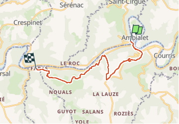

Length
12.5 km

Max alt
432 m

Uphill gradient
507 m
Km-Effort
19.3 km

Min alt
190 m

Downhill gradient
520 m
Boucle
No
Creation date :
2025-04-06 07:04:44.346
Updated on :
2025-04-06 11:31:22.511
3h35
Difficulty : Medium

FREE GPS app for hiking
 SityTrail
IGN / Geographical institutes
SityTrail Plus
The world is yours!
About
Trail Walking of 12.5 km to be discovered at Occitania, Tarn, Saint-Cirgue. This trail is proposed by pidjam.
Positioning
Country:
France
Region :
Occitania
Department/Province :
Tarn
Municipality :
Saint-Cirgue
Location:
Unknown
Start:(Dec)
Start:(UTM)
449920 ; 4866064 (31T) N.
Comments