


Base nautique de Romans

meillon
User

Length
5.3 km

Max alt
174 m

Uphill gradient
31 m
Km-Effort
5.8 km

Min alt
154 m

Downhill gradient
45 m
Boucle
Yes
Creation date :
2025-04-06 14:08:42.01
Updated on :
2025-04-06 16:14:45.927
2h05
Difficulty : Medium

FREE GPS app for hiking
 SityTrail
IGN / Geographical institutes
SityTrail Plus
The world is yours!
About
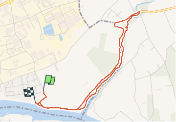
Trail Walking of 5.3 km to be discovered at Auvergne-Rhône-Alpes, Drôme, Romans-sur-Isère. This trail is proposed by meillon.
Description
en suivant la voie verte...retour par la riviere Joyeuse...
Positioning
Country:
France
Region :
Auvergne-Rhône-Alpes
Department/Province :
Drôme
Municipality :
Romans-sur-Isère
Location:
Unknown
Start:(Dec)
Start:(UTM)
664981 ; 4989847 (31T) N.
Comments