


abenowandeling

Benjamin27
User GUIDE
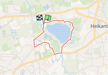

Length
2.7 km

Max alt
18 m

Uphill gradient
13 m
Km-Effort
2.8 km

Min alt
8 m

Downhill gradient
14 m
Boucle
Yes
Creation date :
2025-04-06 16:59:00.0
Updated on :
2025-04-06 20:47:47.251
38m
Difficulty : Easy

FREE GPS app for hiking
 SityTrail
IGN / Geographical institutes
SityTrail Plus
The world is yours!
About
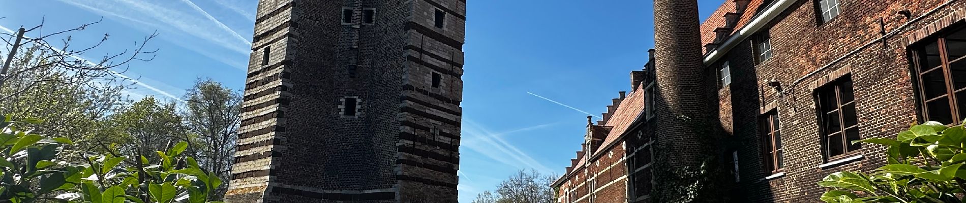
Trail Walking of 2.7 km to be discovered at Flanders, Flemish Brabant, Rotselaar. This trail is proposed by Benjamin27.
Photos

Positioning
Country:
Belgium
Region :
Flanders
Department/Province :
Flemish Brabant
Municipality :
Rotselaar
Location:
Unknown
Start:(Dec)
Start:(UTM)
621042 ; 5646961 (31U) N.
Comments