


volcan Santa Maria

reneperrin
User
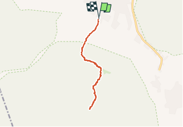

Length
10.2 km

Max alt
3761 m

Uphill gradient
1259 m
Km-Effort
27 km

Min alt
2490 m

Downhill gradient
1266 m
Boucle
Yes
Creation date :
2025-04-05 10:20:17.359
Updated on :
2025-04-07 00:06:29.329
4h17
Difficulty : Difficult

FREE GPS app for hiking
 SityTrail
IGN / Geographical institutes
SityTrail Plus
The world is yours!
About
Trail Walking of 10.2 km to be discovered at Quetzaltenango, Quetzaltenango. This trail is proposed by reneperrin.
Positioning
Country:
Guatemala
Region :
Quetzaltenango
Department/Province :
Quetzaltenango
Municipality :
Unknown
Location:
Unknown
Start:(Dec)
Start:(UTM)
656194 ; 1635264 (15P) N.
Comments