


Saint Rémy de Provence

Roger Philippe Wallez
User GUIDE
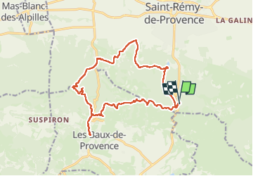

Length
18.3 km

Max alt
304 m

Uphill gradient
402 m
Km-Effort
24 km

Min alt
81 m

Downhill gradient
401 m
Boucle
Yes
Creation date :
2025-04-06 08:05:22.0
Updated on :
2025-04-08 08:03:25.381
6h29
Difficulty : Very difficult

FREE GPS app for hiking
 SityTrail
IGN / Geographical institutes
SityTrail Plus
The world is yours!
About
Trail Walking of 18.3 km to be discovered at Provence-Alpes-Côte d'Azur, Bouches-du-Rhône, Saint-Rémy-de-Provence. This trail is proposed by Roger Philippe Wallez.
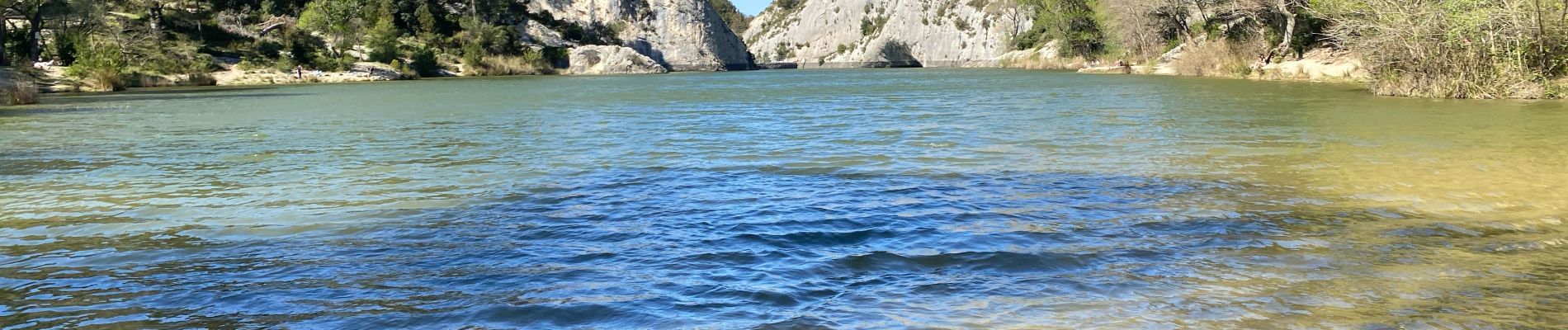
Photos


Positioning
Country:
France
Region :
Provence-Alpes-Côte d'Azur
Department/Province :
Bouches-du-Rhône
Municipality :
Saint-Rémy-de-Provence
Location:
Unknown
Start:(Dec)
Start:(UTM)
647631 ; 4846458 (31T) N.
Comments