


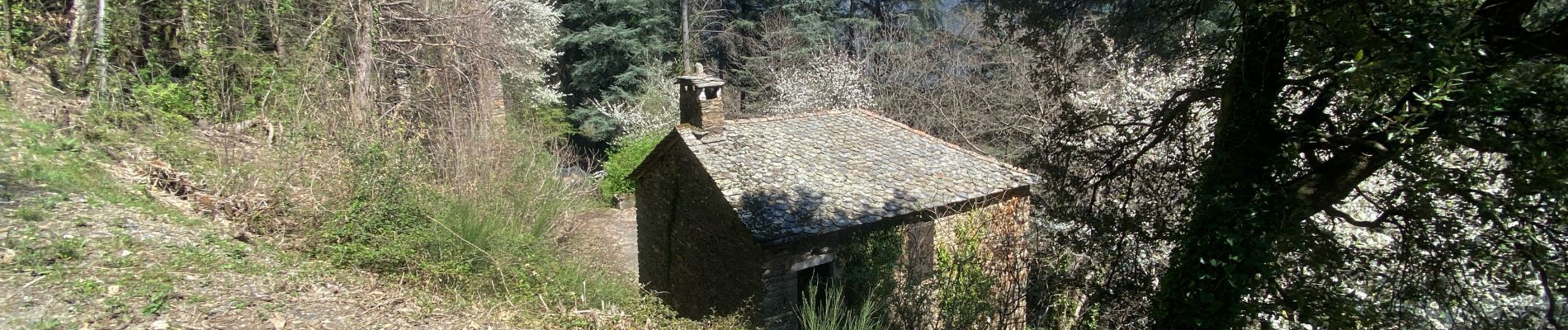
Le Martinet

Roger Philippe Wallez
User GUIDE
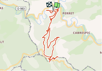

Length
11.9 km

Max alt
677 m

Uphill gradient
522 m
Km-Effort
18.9 km

Min alt
232 m

Downhill gradient
525 m
Boucle
Yes
Creation date :
2025-04-08 08:03:11.0
Updated on :
2025-04-08 13:11:40.255
4h46
Difficulty : Difficult

FREE GPS app for hiking
 SityTrail
IGN / Geographical institutes
SityTrail Plus
The world is yours!
About
Trail Walking of 11.9 km to be discovered at Occitania, Lozère, Saint-Étienne-Vallée-Française. This trail is proposed by Roger Philippe Wallez.
Photos


Positioning
Country:
France
Region :
Occitania
Department/Province :
Lozère
Municipality :
Saint-Étienne-Vallée-Française
Location:
Unknown
Start:(Dec)
Start:(UTM)
567200 ; 4889587 (31T) N.
Comments