


Étape trois de St Régis

Regisconraud
User
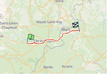

Length
28 km

Max alt
1298 m

Uphill gradient
527 m
Km-Effort
36 km

Min alt
1002 m

Downhill gradient
693 m
Boucle
No
Creation date :
2025-04-08 06:34:37.699
Updated on :
2025-04-08 14:46:12.22
8h10
Difficulty : Very difficult

FREE GPS app for hiking
 SityTrail
IGN / Geographical institutes
SityTrail Plus
The world is yours!
About
Trail Walking of 28 km to be discovered at Auvergne-Rhône-Alpes, Haute-Loire, Saint-Front. This trail is proposed by Regisconraud.
Positioning
Country:
France
Region :
Auvergne-Rhône-Alpes
Department/Province :
Haute-Loire
Municipality :
Saint-Front
Location:
Unknown
Start:(Dec)
Start:(UTM)
590044 ; 4980858 (31T) N.
Comments