


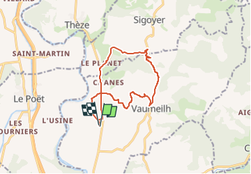
Chapelle St Marcelin Col de Grêle

PatriceCocuaud
User

Length
13 km

Max alt
732 m

Uphill gradient
280 m
Km-Effort
16.7 km

Min alt
524 m

Downhill gradient
279 m
Boucle
Yes
Creation date :
2025-04-08 15:11:42.799
Updated on :
2025-04-08 16:16:04.892
56m
Difficulty : Medium

FREE GPS app for hiking
 SityTrail
IGN / Geographical institutes
SityTrail Plus
The world is yours!
About
Trail Mountain bike of 13 km to be discovered at Provence-Alpes-Côte d'Azur, Alpes-de-Haute-Provence, Vaumeilh. This trail is proposed by PatriceCocuaud.
Positioning
Country:
France
Region :
Provence-Alpes-Côte d'Azur
Department/Province :
Alpes-de-Haute-Provence
Municipality :
Vaumeilh
Location:
Unknown
Start:(Dec)
Start:(UTM)
734036 ; 4907400 (31T) N.
Comments