


chapelle ste maxime

vincente204
User
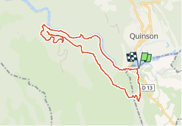

Length
11.1 km

Max alt
548 m

Uphill gradient
380 m
Km-Effort
16.2 km

Min alt
358 m

Downhill gradient
380 m
Boucle
Yes
Creation date :
2025-04-09 07:42:19.91
Updated on :
2025-04-09 13:24:59.09
5h22
Difficulty : Difficult

FREE GPS app for hiking
 SityTrail
IGN / Geographical institutes
SityTrail Plus
The world is yours!
About
Trail Walking of 11.1 km to be discovered at Provence-Alpes-Côte d'Azur, Var, Montmeyan. This trail is proposed by vincente204.
Description
facile
Positioning
Country:
France
Region :
Provence-Alpes-Côte d'Azur
Department/Province :
Var
Municipality :
Montmeyan
Location:
Unknown
Start:(Dec)
Start:(UTM)
261314 ; 4842142 (32T) N.
Comments