


marsanne-borne rousse 08-04-2025

parastat
User
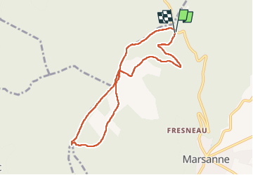

Length
8.4 km

Max alt
596 m

Uphill gradient
249 m
Km-Effort
11.8 km

Min alt
478 m

Downhill gradient
254 m
Boucle
Yes
Creation date :
2025-04-08 11:22:34.652
Updated on :
2025-04-09 13:58:42.028
2h40
Difficulty : Medium

FREE GPS app for hiking
 SityTrail
IGN / Geographical institutes
SityTrail Plus
The world is yours!
About
Trail Walking of 8.4 km to be discovered at Auvergne-Rhône-Alpes, Drôme, Marsanne. This trail is proposed by parastat.
Description
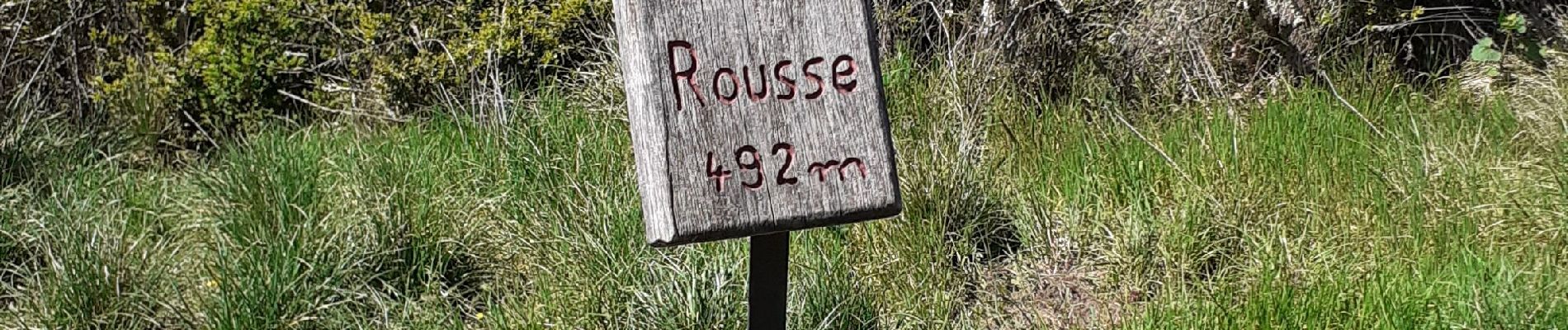
C'est la limite des communes de La Laupie, Condillac et Marsanne.
Il n'y a hélas ni borne ni rousse ( en tout cas je n'ai pas vu) mais une vue splendide sur la vallée de Rhône.
Photos

Positioning
Country:
France
Region :
Auvergne-Rhône-Alpes
Department/Province :
Drôme
Municipality :
Marsanne
Location:
Unknown
Start:(Dec)
Start:(UTM)
647908 ; 4947513 (31T) N.
Comments