


Étape quatre de St Régis

Regisconraud
User

Length
30 km

Max alt
1122 m

Uphill gradient
956 m
Km-Effort
43 km

Min alt
614 m

Downhill gradient
926 m
Boucle
No
Creation date :
2025-04-09 06:02:47.545
Updated on :
2025-04-09 15:43:50.553
9h39
Difficulty : Very difficult

FREE GPS app for hiking
 SityTrail
IGN / Geographical institutes
SityTrail Plus
The world is yours!
About
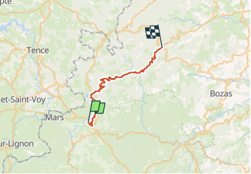
Trail Walking of 30 km to be discovered at Auvergne-Rhône-Alpes, Ardèche, Saint-Agrève. This trail is proposed by Regisconraud.
Positioning
Country:
France
Region :
Auvergne-Rhône-Alpes
Department/Province :
Ardèche
Municipality :
Saint-Agrève
Location:
Unknown
Start:(Dec)
Start:(UTM)
609442 ; 4985440 (31T) N.
Comments