


boucle des canalettes

jeff2
User
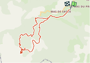

Length
13.7 km

Max alt
738 m

Uphill gradient
336 m
Km-Effort
18.2 km

Min alt
517 m

Downhill gradient
338 m
Boucle
Yes
Creation date :
2025-04-10 07:52:53.876
Updated on :
2025-04-10 13:34:35.883
4h53
Difficulty : Medium

FREE GPS app for hiking
 SityTrail
IGN / Geographical institutes
SityTrail Plus
The world is yours!
About
Trail Walking of 13.7 km to be discovered at Occitania, Aveyron, Nant. This trail is proposed by jeff2.
Description
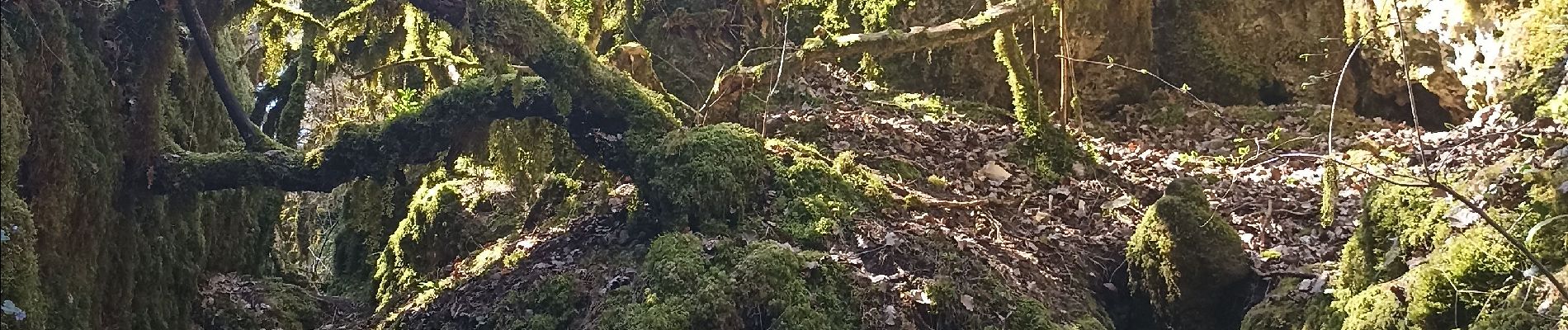
Jolie balade, grand beau, Canoles 1&2 a ne pas rater.
Photos


28 photos in total. Please click on a photo to see them all in the gallery.
Positioning
Country:
France
Region :
Occitania
Department/Province :
Aveyron
Municipality :
Nant
Location:
Unknown
Start:(Dec)
Start:(UTM)
522894 ; 4871385 (31T) N.
Comments