


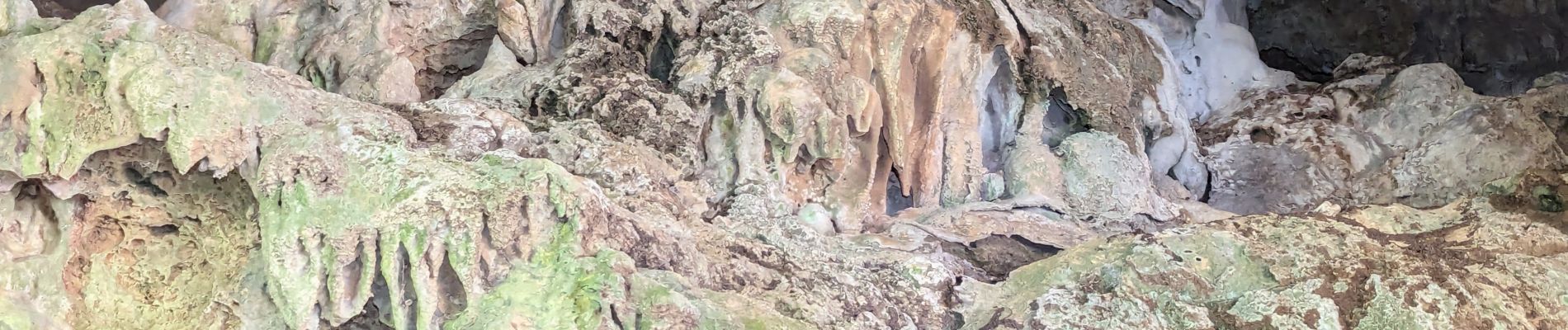
La Grotte des Fées

ARVIEU
User

Length
14 km

Max alt
450 m

Uphill gradient
444 m
Km-Effort
19.9 km

Min alt
151 m

Downhill gradient
444 m
Boucle
Yes
Creation date :
2025-04-11 08:33:04.481
Updated on :
2025-04-11 08:38:10.031
4h31
Difficulty : Medium

FREE GPS app for hiking
 SityTrail
IGN / Geographical institutes
SityTrail Plus
The world is yours!
About
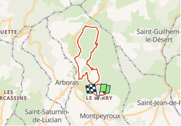
Trail Walking of 14 km to be discovered at Occitania, Hérault, Montpeyroux. This trail is proposed by ARVIEU.
Description
départ: Le Barry
ruisseau du Joncas, Grotte des Fées, le Joncas, intersection ruisseau du Vent RD 122, descente vers le Poujolet, cote 333 RD 122, les Cocalières, le Castelas
Photos


Positioning
Country:
France
Region :
Occitania
Department/Province :
Hérault
Municipality :
Montpeyroux
Location:
Unknown
Start:(Dec)
Start:(UTM)
540862 ; 4838898 (31T) N.
Comments