


campan G3 Courtaou empeye

LouisROGER
User GUIDE
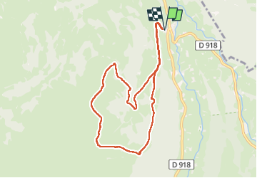

Length
9.4 km

Max alt
1451 m

Uphill gradient
615 m
Km-Effort
17.6 km

Min alt
865 m

Downhill gradient
615 m
Boucle
Yes
Creation date :
2025-04-11 07:32:39.383
Updated on :
2025-04-11 13:11:16.858
5h38
Difficulty : Difficult

FREE GPS app for hiking
 SityTrail
IGN / Geographical institutes
SityTrail Plus
The world is yours!
About
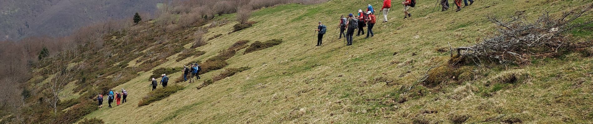
Trail Walking of 9.4 km to be discovered at Occitania, Hautespyrenees, Campan. This trail is proposed by LouisROGER.
Photos


Positioning
Country:
France
Region :
Occitania
Department/Province :
Hautespyrenees
Municipality :
Campan
Location:
Unknown
Start:(Dec)
Start:(UTM)
273848 ; 4762823 (31T) N.
Comments