


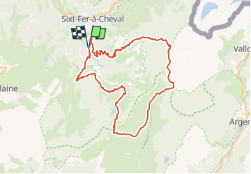
buet-en-boucle-depuis-sixt

topolino
User

Length
38 km

Max alt
3083 m

Uphill gradient
2923 m
Km-Effort
77 km

Min alt
845 m

Downhill gradient
2924 m
Boucle
Yes
Creation date :
2025-04-12 07:52:25.528
Updated on :
2025-04-12 07:52:51.901
5h19
Difficulty : Very difficult

FREE GPS app for hiking
 SityTrail
IGN / Geographical institutes
SityTrail Plus
The world is yours!
About
Trail Mountain bike of 38 km to be discovered at Auvergne-Rhône-Alpes, Upper Savoy, Sixt-Fer-à-Cheval. This trail is proposed by topolino.
Description
Sixt, Grenairon, Buet, Salenton, Anterne, Saufflaz, Lignon
Positioning
Country:
France
Region :
Auvergne-Rhône-Alpes
Department/Province :
Upper Savoy
Municipality :
Sixt-Fer-à-Cheval
Location:
Unknown
Start:(Dec)
Start:(UTM)
327588 ; 5100287 (32T) N.
Comments