


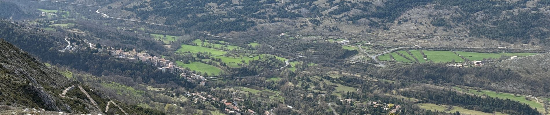
Coursegoules - La Croix de Versé

GeorgesV.
User
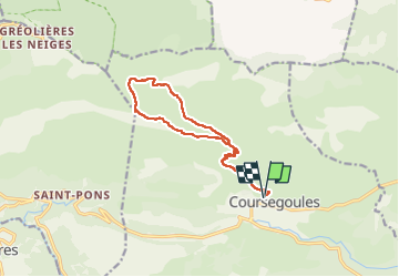

Length
14.3 km

Max alt
1687 m

Uphill gradient
754 m
Km-Effort
24 km

Min alt
1014 m

Downhill gradient
755 m
Boucle
Yes
Creation date :
2025-04-12 06:35:08.0
Updated on :
2025-04-12 17:11:23.66
5h31
Difficulty : Difficult

FREE GPS app for hiking
 SityTrail
IGN / Geographical institutes
SityTrail Plus
The world is yours!
About
Trail Walking of 14.3 km to be discovered at Provence-Alpes-Côte d'Azur, Maritime Alps, Coursegoules. This trail is proposed by GeorgesV..
Photos


Positioning
Country:
France
Region :
Provence-Alpes-Côte d'Azur
Department/Province :
Maritime Alps
Municipality :
Coursegoules
Location:
Unknown
Start:(Dec)
Start:(UTM)
342366 ; 4850939 (32T) N.
Comments