


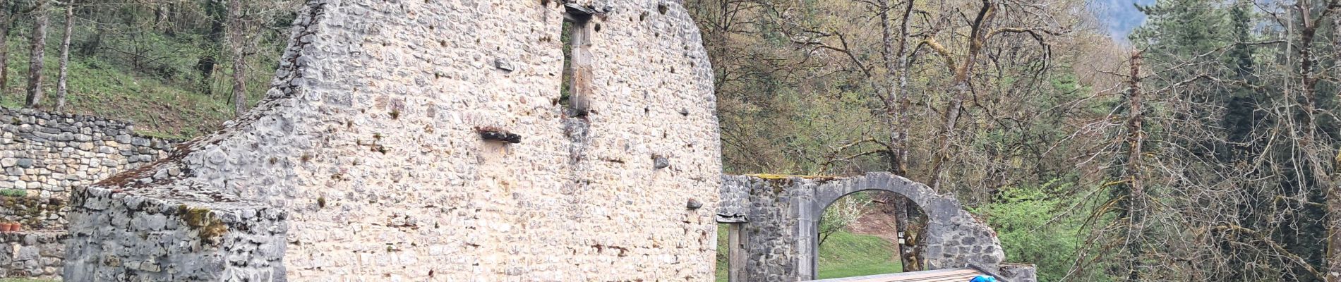
AIN / SUR LYAND: GRANGE D'EN BAS - PONT DU FAON

djeepee74
User


5h18
Difficulty : Medium

FREE GPS app for hiking
 SityTrail
IGN / Geographical institutes
SityTrail Plus
The world is yours!
About
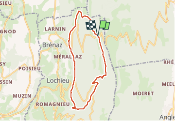
Trail Walking of 14.5 km to be discovered at Auvergne-Rhône-Alpes, Ain, Arvière-en-Valromey. This trail is proposed by djeepee74.
Description
BOUCLE... live du 20250412
Afin de limiter les risques par temps humide, il est préférable de parcourir la boucle dans le sens opposé à celui décrit... en effet, la descente depuis Arvière jusqu'au Pont du Faon est pentue et glissante par sol mouillé !
Photos


Positioning
Comments