


Montagne Noire - Tronçon 1

zazibelle
User

Length
18.7 km

Max alt
944 m

Uphill gradient
921 m
Km-Effort
29 km

Min alt
242 m

Downhill gradient
328 m
Boucle
No
Creation date :
2025-04-13 19:43:03.984
Updated on :
2025-04-13 19:53:57.222
6h36
Difficulty : Very difficult

FREE GPS app for hiking
 SityTrail
IGN / Geographical institutes
SityTrail Plus
The world is yours!
About
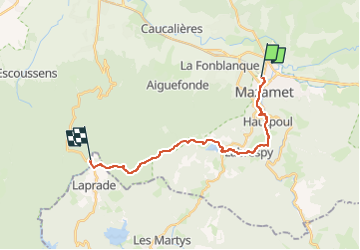
Trail Walking of 18.7 km to be discovered at Occitania, Tarn, Mazamet. This trail is proposed by zazibelle.
Positioning
Country:
France
Region :
Occitania
Department/Province :
Tarn
Municipality :
Mazamet
Location:
Unknown
Start:(Dec)
Start:(UTM)
449434 ; 4816278 (31T) N.
Comments