


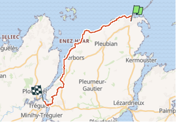
Gr34 Sillon de talbert Tréguier

taguette
User

Length
19.5 km

Max alt
68 m

Uphill gradient
206 m
Km-Effort
22 km

Min alt
-1 m

Downhill gradient
220 m
Boucle
No
Creation date :
2025-04-14 06:14:51.047
Updated on :
2025-04-14 11:50:24.522
5h35
Difficulty : Very difficult

FREE GPS app for hiking
 SityTrail
IGN / Geographical institutes
SityTrail Plus
The world is yours!
About
Trail Walking of 19.5 km to be discovered at Brittany, Côtes-d'Armor, Pleubian. This trail is proposed by taguette.
Positioning
Country:
France
Region :
Brittany
Department/Province :
Côtes-d'Armor
Municipality :
Pleubian
Location:
Unknown
Start:(Dec)
Start:(UTM)
492480 ; 5412175 (30U) N.
Comments