


Compostelle 14 - Cajarc -> Limogne

uru2010
User
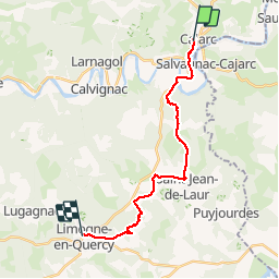

Length
18.3 km

Max alt
374 m

Uphill gradient
452 m
Km-Effort
24 km

Min alt
142 m

Downhill gradient
297 m
Boucle
No
Creation date :
2018-06-12 00:00:00.0
Updated on :
2018-06-12 00:00:00.0
5h09
Difficulty : Very easy

FREE GPS app for hiking
 SityTrail
IGN / Geographical institutes
SityTrail Plus
The world is yours!
About
Trail Walking of 18.3 km to be discovered at Occitania, Lot, Cajarc. This trail is proposed by uru2010.
Description
Cajarc -> Limogne
Positioning
Country:
France
Region :
Occitania
Department/Province :
Lot
Municipality :
Cajarc
Location:
Unknown
Start:(Dec)
Start:(UTM)
407684 ; 4926503 (31T) N.
Comments
