


GS 2025_05_04 Hauts-Champs Livr.2/3e Définitif

Mercenier
User
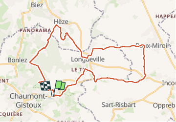

Length
20 km

Max alt
146 m

Uphill gradient
268 m
Km-Effort
24 km

Min alt
75 m

Downhill gradient
267 m
Boucle
Yes
Creation date :
2025-04-08 07:48:37.695
Updated on :
2025-04-15 09:04:09.587
4h55
Difficulty : Very difficult

FREE GPS app for hiking
 SityTrail
IGN / Geographical institutes
SityTrail Plus
The world is yours!
About
Trail Walking of 20 km to be discovered at Wallonia, Walloon Brabant, Chaumont-Gistoux. This trail is proposed by Mercenier.
Photos


Positioning
Country:
Belgium
Region :
Wallonia
Department/Province :
Walloon Brabant
Municipality :
Chaumont-Gistoux
Location:
Unknown
Start:(Dec)
Start:(UTM)
621158 ; 5616277 (31U) N.
Comments