


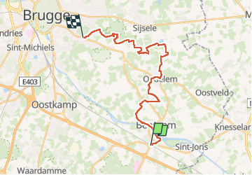
Beernem - Oedelem - Assebroek

kimpej
User

Length
22 km

Max alt
19 m

Uphill gradient
123 m
Km-Effort
24 km

Min alt
1 m

Downhill gradient
130 m
Boucle
No
Creation date :
2025-04-16 07:15:38.035
Updated on :
2025-05-03 13:21:50.536
5h24
Difficulty : Very difficult

FREE GPS app for hiking
 SityTrail
IGN / Geographical institutes
SityTrail Plus
The world is yours!
About
Trail Walking of 22 km to be discovered at Flanders, West Flanders, Beernem. This trail is proposed by kimpej.
Description
Beernem - Assebroel
Positioning
Country:
Belgium
Region :
Flanders
Department/Province :
West Flanders
Municipality :
Beernem
Location:
Beernem
Start:(Dec)
Start:(UTM)
523083 ; 5664150 (31U) N.
Comments