


blo mare aux evees

Martin Cassol
User
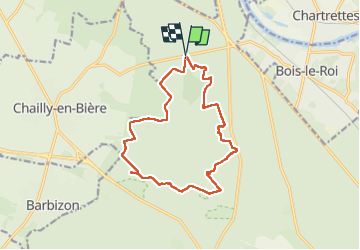

Length
14.1 km

Max alt
151 m

Uphill gradient
156 m
Km-Effort
16.2 km

Min alt
82 m

Downhill gradient
158 m
Boucle
Yes
Creation date :
2025-04-16 08:26:13.181
Updated on :
2025-04-16 20:52:44.944
3h24
Difficulty : Easy

FREE GPS app for hiking
 SityTrail
IGN / Geographical institutes
SityTrail Plus
The world is yours!
About
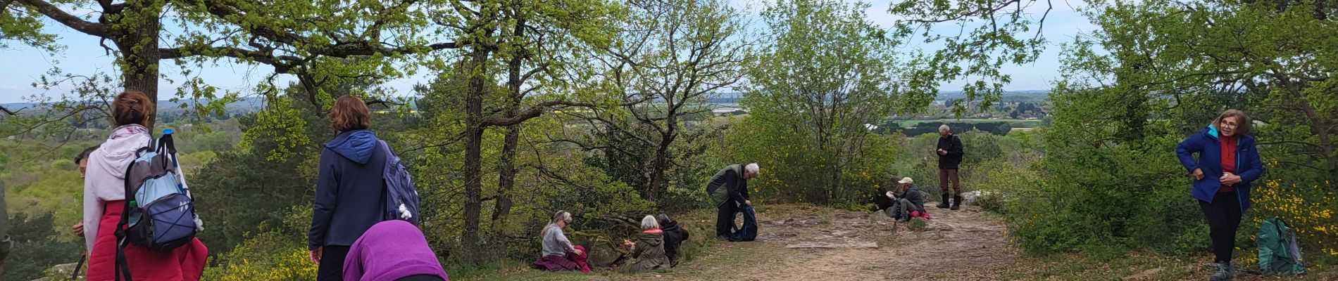
Trail Walking of 14.1 km to be discovered at Ile-de-France, Seine-et-Marne, Fontainebleau. This trail is proposed by Martin Cassol.
Photos


Positioning
Country:
France
Region :
Ile-de-France
Department/Province :
Seine-et-Marne
Municipality :
Fontainebleau
Location:
Unknown
Start:(Dec)
Start:(UTM)
474296 ; 5369498 (31U) N.
Comments