


Bonsaï

danif
User
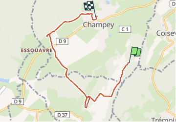

Length
6.9 km

Max alt
461 m

Uphill gradient
70 m
Km-Effort
8.2 km

Min alt
353 m

Downhill gradient
171 m
Boucle
No
Creation date :
2025-04-17 14:01:07.416
Updated on :
2025-04-17 15:40:46.464
1h39
Difficulty : Medium

FREE GPS app for hiking
 SityTrail
IGN / Geographical institutes
SityTrail Plus
The world is yours!
About
Trail Walking of 6.9 km to be discovered at Bourgogne-Franche-Comté, Haute-Saône, Champey. This trail is proposed by danif.
Positioning
Country:
France
Region :
Bourgogne-Franche-Comté
Department/Province :
Haute-Saône
Municipality :
Champey
Location:
Unknown
Start:(Dec)
Start:(UTM)
326369 ; 5271712 (32T) N.
Comments