


le Moure des Gardilles / Les Sources de l'Allier

tyntyn
User
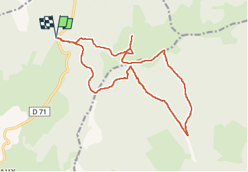

Length
10.4 km

Max alt
1502 m

Uphill gradient
371 m
Km-Effort
15.4 km

Min alt
1259 m

Downhill gradient
371 m
Boucle
Yes
Creation date :
2025-04-18 11:21:09.529
Updated on :
2025-04-18 15:15:34.936
3h53
Difficulty : Easy

FREE GPS app for hiking
 SityTrail
IGN / Geographical institutes
SityTrail Plus
The world is yours!
About
Trail Walking of 10.4 km to be discovered at Occitania, Lozère, Saint-Frézal-d'Albuges. This trail is proposed by tyntyn.
Positioning
Country:
France
Region :
Occitania
Department/Province :
Lozère
Municipality :
Saint-Frézal-d'Albuges
Location:
Unknown
Start:(Dec)
Start:(UTM)
561428 ; 4938072 (31T) N.
Comments