


mont st Odile, chemin de croix

apa
User
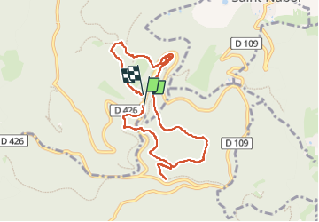

Length
8.7 km

Max alt
831 m

Uphill gradient
269 m
Km-Effort
12.4 km

Min alt
668 m

Downhill gradient
287 m
Boucle
Yes
Creation date :
2025-04-19 09:58:26.535
Updated on :
2025-04-19 13:01:13.679
2h00
Difficulty : Difficult

FREE GPS app for hiking
 SityTrail
IGN / Geographical institutes
SityTrail Plus
The world is yours!
About
Trail Walking of 8.7 km to be discovered at Grand Est, Bas-Rhin, Ottrott. This trail is proposed by apa.
Photos


Positioning
Country:
France
Region :
Grand Est
Department/Province :
Bas-Rhin
Municipality :
Ottrott
Location:
Unknown
Start:(Dec)
Start:(UTM)
381676 ; 5365536 (32U) N.
Comments