


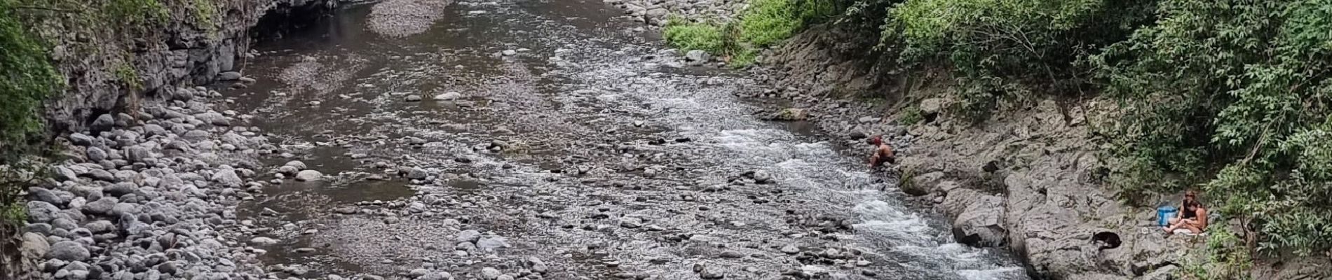
fond de la rivière - pont de liane

prv
User
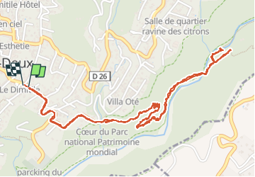

Length
5.4 km

Max alt
400 m

Uphill gradient
187 m
Km-Effort
7.9 km

Min alt
233 m

Downhill gradient
188 m
Boucle
Yes
Creation date :
2025-04-20 10:12:17.037
Updated on :
2025-04-20 12:18:06.458
2h05
Difficulty : Very easy

FREE GPS app for hiking
 SityTrail
IGN / Geographical institutes
SityTrail Plus
The world is yours!
About
Trail Walking of 5.4 km to be discovered at Réunion, Unknown, Entre-Deux. This trail is proposed by prv.
Photos


Positioning
Country:
France
Region :
Réunion
Department/Province :
Unknown
Municipality :
Entre-Deux
Location:
Unknown
Start:(Dec)
Start:(UTM)
341439 ; 7649417 (40K) S.
Comments
pour un pique nique au bord de l'eau 😉