


LA PISSOIRE AR

surceneux
User
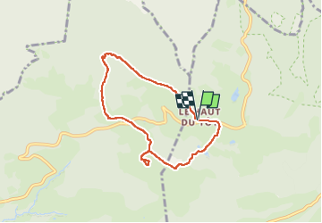

Length
6.3 km

Max alt
854 m

Uphill gradient
179 m
Km-Effort
8.7 km

Min alt
739 m

Downhill gradient
181 m
Boucle
Yes
Creation date :
2025-04-19 12:57:46.488
Updated on :
2025-04-20 12:49:25.842
1h50
Difficulty : Easy

FREE GPS app for hiking
 SityTrail
IGN / Geographical institutes
SityTrail Plus
The world is yours!
About
Trail Walking of 6.3 km to be discovered at Grand Est, Vosges, Sapois. This trail is proposed by surceneux.
Positioning
Country:
France
Region :
Grand Est
Department/Province :
Vosges
Municipality :
Sapois
Location:
Unknown
Start:(Dec)
Start:(UTM)
333328 ; 5323379 (32U) N.
Comments