


Cabane de Banios

chasle
User
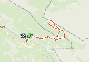

Length
9.2 km

Max alt
1563 m

Uphill gradient
812 m
Km-Effort
20 km

Min alt
758 m

Downhill gradient
814 m
Boucle
Yes
Creation date :
2025-04-20 06:42:05.271
Updated on :
2025-04-20 14:33:02.452
4h33
Difficulty : Very difficult

FREE GPS app for hiking
 SityTrail
IGN / Geographical institutes
SityTrail Plus
The world is yours!
About
Trail Walking of 9.2 km to be discovered at Occitania, Hautespyrenees, Campan. This trail is proposed by chasle.
Positioning
Country:
France
Region :
Occitania
Department/Province :
Hautespyrenees
Municipality :
Campan
Location:
Unknown
Start:(Dec)
Start:(UTM)
273000 ; 4763980 (31T) N.
Comments