


Séné vas

Roger Philippe Wallez
User GUIDE

Length
18.2 km

Max alt
489 m

Uphill gradient
798 m
Km-Effort
29 km

Min alt
232 m

Downhill gradient
805 m
Boucle
Yes
Creation date :
2025-04-20 08:07:04.0
Updated on :
2025-04-20 15:55:30.989
7h43
Difficulty : Very difficult

FREE GPS app for hiking
 SityTrail
IGN / Geographical institutes
SityTrail Plus
The world is yours!
About
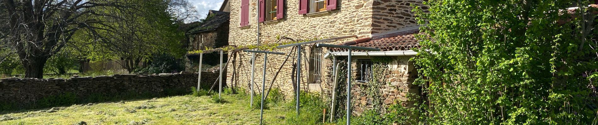
Trail Walking of 18.2 km to be discovered at Occitania, Gard, Sénéchas. This trail is proposed by Roger Philippe Wallez.
Photos


29 photos in total. Please click on a photo to see them all in the gallery.
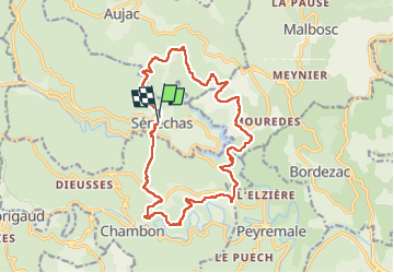
Positioning
Country:
France
Region :
Occitania
Department/Province :
Gard
Municipality :
Sénéchas
Location:
Unknown
Start:(Dec)
Start:(UTM)
581820 ; 4908577 (31T) N.
Comments