


Potelieres

asclier0
User
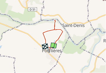

Length
4.4 km

Max alt
144 m

Uphill gradient
34 m
Km-Effort
4.9 km

Min alt
115 m

Downhill gradient
33 m
Boucle
Yes
Creation date :
2025-04-21 08:05:51.0
Updated on :
2025-04-21 09:20:15.376
1h07
Difficulty : Easy

FREE GPS app for hiking
 SityTrail
IGN / Geographical institutes
SityTrail Plus
The world is yours!
About
Trail Walking of 4.4 km to be discovered at Occitania, Gard, Potelières. This trail is proposed by asclier0.
Positioning
Country:
France
Region :
Occitania
Department/Province :
Gard
Municipality :
Potelières
Location:
Unknown
Start:(Dec)
Start:(UTM)
598804 ; 4897277 (31T) N.
Comments