


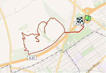
NORD: LOOS EN GOHELLE / TERRILS JUMEAUX

djeepee74
User

Length
5.2 km

Max alt
160 m

Uphill gradient
124 m
Km-Effort
6.9 km

Min alt
64 m

Downhill gradient
121 m
Boucle
Yes
Creation date :
2025-04-22 13:18:18.117
Updated on :
2025-04-26 10:15:26.529
1h33
Difficulty : Easy

FREE GPS app for hiking
 SityTrail
IGN / Geographical institutes
SityTrail Plus
The world is yours!
About
Trail Walking of 5.2 km to be discovered at Hauts-de-France, Pas-de-Calais, Loos-en-Gohelle. This trail is proposed by djeepee74.
Description
BOUCLE ... live 20250422
La descente par le "goulet" est courte, mais raide et équipée de marches très hautes.
Le terril 74 (188 m.) est fermé au public... pour cause d'érosion !
Positioning
Country:
France
Region :
Hauts-de-France
Department/Province :
Pas-de-Calais
Municipality :
Loos-en-Gohelle
Location:
Unknown
Start:(Dec)
Start:(UTM)
485225 ; 5588297 (31U) N.
Comments