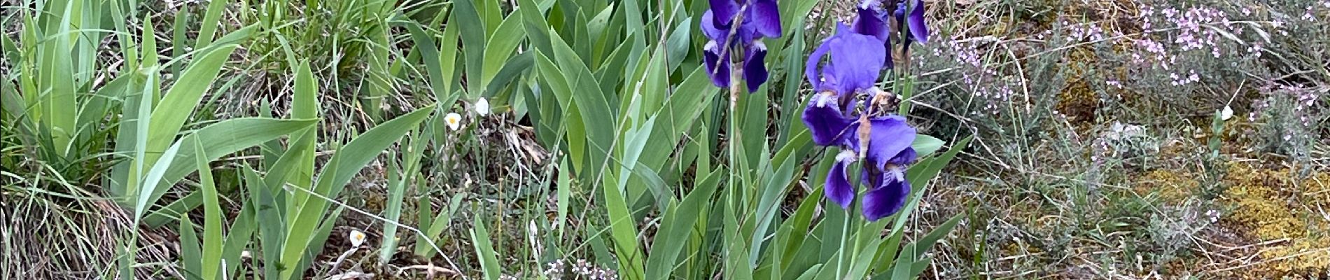
Sentier des orchidées JLC1

jl_chocho
User
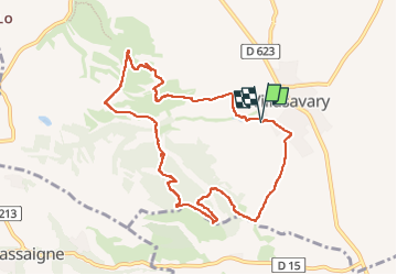

Length
10.3 km

Max alt
315 m

Uphill gradient
264 m
Km-Effort
13.8 km

Min alt
181 m

Downhill gradient
265 m
Boucle
Yes
Creation date :
2025-04-22 12:29:25.0
Updated on :
2025-04-22 17:38:51.848
2h24
Difficulty : Difficult

FREE GPS app for hiking
 SityTrail
IGN / Geographical institutes
SityTrail Plus
The world is yours!
About
Trail Walking of 10.3 km to be discovered at Occitania, Aude, Villasavary. This trail is proposed by jl_chocho.
Photos


Positioning
Country:
France
Region :
Occitania
Department/Province :
Aude
Municipality :
Villasavary
Location:
Unknown
Start:(Dec)
Start:(UTM)
421541 ; 4785537 (31T) N.
Comments