


Runtdfjellet (Lyngen nord)

GOHIER
User
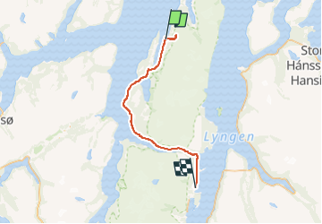

Length
61 km

Max alt
676 m

Uphill gradient
1236 m
Km-Effort
77 km

Min alt
-2 m

Downhill gradient
1238 m
Boucle
No
Creation date :
2025-04-23 10:53:44.0
Updated on :
2025-04-23 16:14:14.905
5h17
Difficulty : Easy

FREE GPS app for hiking
 SityTrail
IGN / Geographical institutes
SityTrail Plus
The world is yours!
About
Trail Touring skiing of 61 km to be discovered at Troms og Finnmark. This trail is proposed by GOHIER.
Description
Depuis Nordmannwik. Poudreuse hyper légère. Avec Bernard et Bruno
Positioning
Country:
Norway
Region :
Troms og Finnmark
Department/Province :
Unknown
Municipality :
Unknown
Location:
Unknown
Start:(Dec)
Start:(UTM)
462684 ; 7746505 (34W) N.
Comments