


Lac d' Isaby

chasle
User
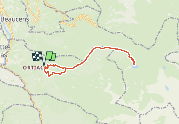

Length
15 km

Max alt
1577 m

Uphill gradient
858 m
Km-Effort
26 km

Min alt
796 m

Downhill gradient
860 m
Boucle
Yes
Creation date :
2025-04-24 07:03:33.467
Updated on :
2025-04-24 15:37:07.011
4h21
Difficulty : Difficult

FREE GPS app for hiking
 SityTrail
IGN / Geographical institutes
SityTrail Plus
The world is yours!
About
Trail Walking of 15 km to be discovered at Occitania, Hautespyrenees, Villelongue. This trail is proposed by chasle.
Positioning
Country:
France
Region :
Occitania
Department/Province :
Hautespyrenees
Municipality :
Villelongue
Location:
Unknown
Start:(Dec)
Start:(UTM)
741511 ; 4759593 (30T) N.
Comments