


TOULAUD RANDO Corniches de l'Érieux

TOULAUDIN
User

Length
14.8 km

Max alt
645 m

Uphill gradient
544 m
Km-Effort
22 km

Min alt
339 m

Downhill gradient
542 m
Boucle
Yes
Creation date :
2025-04-25 07:37:58.767
Updated on :
2025-04-26 07:17:38.927
4h20
Difficulty : Medium

FREE GPS app for hiking
 SityTrail
IGN / Geographical institutes
SityTrail Plus
The world is yours!
About
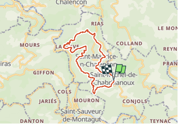
Trail Walking of 14.8 km to be discovered at Auvergne-Rhône-Alpes, Ardèche, Saint-Michel-de-Chabrillanoux. This trail is proposed by TOULAUDIN.
Description
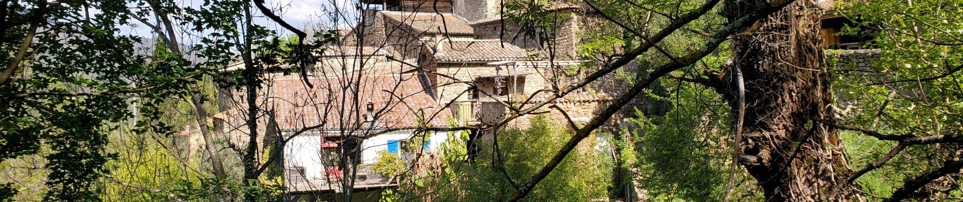
trace effectuée le 25/4/25 très beau parcours , vues magnifiques sur la vallée de l'Eyrieux,quelques passages ou il faut être attentif
à éviter par temps de pluie
Photos


Positioning
Country:
France
Region :
Auvergne-Rhône-Alpes
Department/Province :
Ardèche
Municipality :
Saint-Michel-de-Chabrillanoux
Location:
Unknown
Start:(Dec)
Start:(UTM)
626654 ; 4966294 (31T) N.
Comments