


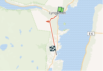
Refuge au-dessus de Lyngseidet

GOHIER
User

Length
10.8 km

Max alt
485 m

Uphill gradient
450 m
Km-Effort
17 km

Min alt
4 m

Downhill gradient
523 m
Boucle
No
Creation date :
2025-04-25 14:46:19.0
Updated on :
2025-04-25 18:28:20.738
2h55
Difficulty : Easy

FREE GPS app for hiking
 SityTrail
IGN / Geographical institutes
SityTrail Plus
The world is yours!
About
Trail Touring skiing of 10.8 km to be discovered at Troms og Finnmark. This trail is proposed by GOHIER.
Description
Une rando démarrée à 16:30: une première !
Positioning
Country:
Norway
Region :
Troms og Finnmark
Department/Province :
Unknown
Municipality :
Unknown
Location:
Unknown
Start:(Dec)
Start:(UTM)
469442 ; 7718175 (34W) N.
Comments