


Sivergues

mb83serre
User GUIDE
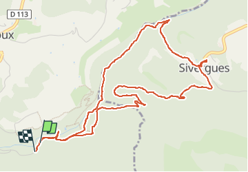

Length
6.9 km

Max alt
581 m

Uphill gradient
216 m
Km-Effort
9.7 km

Min alt
406 m

Downhill gradient
214 m
Boucle
Yes
Creation date :
2025-04-26 07:34:52.29
Updated on :
2025-04-27 16:41:05.074
2h24
Difficulty : Medium

FREE GPS app for hiking
 SityTrail
IGN / Geographical institutes
SityTrail Plus
The world is yours!
About
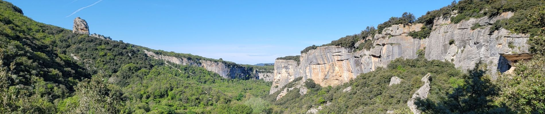
Trail Walking of 6.9 km to be discovered at Provence-Alpes-Côte d'Azur, Vaucluse, Buoux. This trail is proposed by mb83serre.
Photos


Positioning
Country:
France
Region :
Provence-Alpes-Côte d'Azur
Department/Province :
Vaucluse
Municipality :
Buoux
Location:
Unknown
Start:(Dec)
Start:(UTM)
691634 ; 4854809 (31T) N.
Comments