


20250427 Camembert 02

Jeanclaudebic
User
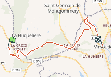

Length
7.5 km

Max alt
225 m

Uphill gradient
92 m
Km-Effort
8.9 km

Min alt
91 m

Downhill gradient
159 m
Boucle
No
Creation date :
2025-04-27 12:29:48.582
Updated on :
2025-04-27 14:17:36.052
1h47
Difficulty : Medium

FREE GPS app for hiking
 SityTrail
IGN / Geographical institutes
SityTrail Plus
The world is yours!
About
Trail Walking of 7.5 km to be discovered at Normandy, Orne, Crouttes. This trail is proposed by Jeanclaudebic.
Positioning
Country:
France
Region :
Normandy
Department/Province :
Orne
Municipality :
Crouttes
Location:
Unknown
Start:(Dec)
Start:(UTM)
290755 ; 5423576 (31U) N.
Comments