


Le Chaumont

nicolasdresse
User
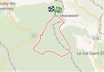

Length
5.9 km

Max alt
412 m

Uphill gradient
157 m
Km-Effort
8 km

Min alt
337 m

Downhill gradient
156 m
Boucle
Yes
Creation date :
2025-04-27 15:05:53.0
Updated on :
2025-04-27 17:07:37.302
2h01
Difficulty : Medium

FREE GPS app for hiking
 SityTrail
IGN / Geographical institutes
SityTrail Plus
The world is yours!
About
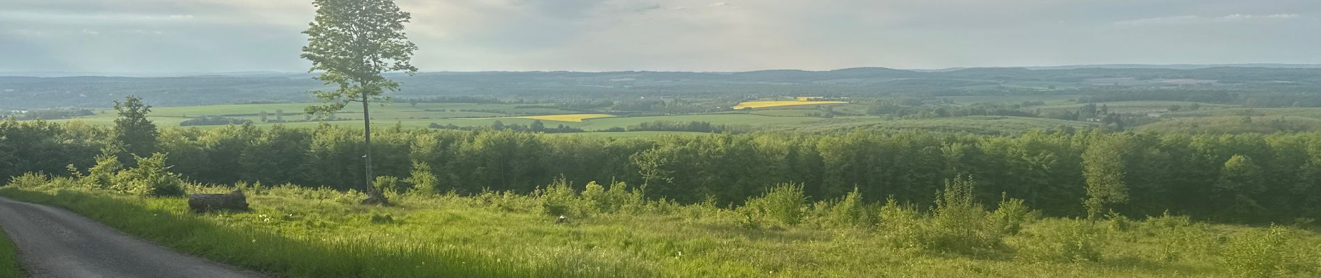
Trail Walking of 5.9 km to be discovered at Bourgogne-Franche-Comté, Haute-Saône, Breurey-lès-Faverney. This trail is proposed by nicolasdresse.
Photos

Positioning
Country:
France
Region :
Bourgogne-Franche-Comté
Department/Province :
Haute-Saône
Municipality :
Breurey-lès-Faverney
Location:
Unknown
Start:(Dec)
Start:(UTM)
287204 ; 5292626 (32T) N.
Comments