


Puy Sanière boucle spéciale Jeff lundi

damlou
User
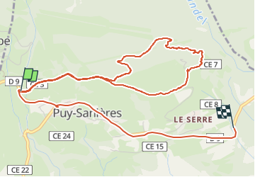

Length
7.2 km

Max alt
1371 m

Uphill gradient
187 m
Km-Effort
10.1 km

Min alt
1090 m

Downhill gradient
309 m
Boucle
No
Creation date :
2025-04-28 07:11:32.674
Updated on :
2025-04-28 09:29:08.283
1h19
Difficulty : Very easy

FREE GPS app for hiking
 SityTrail
IGN / Geographical institutes
SityTrail Plus
The world is yours!
About
Trail Walking of 7.2 km to be discovered at Provence-Alpes-Côte d'Azur, Hautes-Alpes, Puy-Sanières. This trail is proposed by damlou.
Positioning
Country:
France
Region :
Provence-Alpes-Côte d'Azur
Department/Province :
Hautes-Alpes
Municipality :
Puy-Sanières
Location:
Unknown
Start:(Dec)
Start:(UTM)
295526 ; 4937234 (32T) N.
Comments