Trail Walking Castellar - 
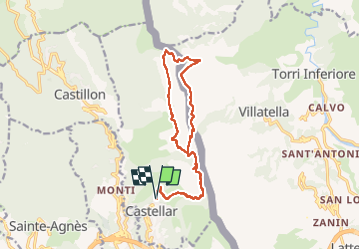
Grammondo depuis Castellar - Photo
© OpenStreetMap contributors
Length
Length
17.5 km
Max alt
Max alt
1369 m
Uphill gradient
Uphill gradient
1487 m
Km-Effort
Km-Effort  
37 km
Min alt
Min alt
351 m
Downhill gradient
Downhill gradient
1483 m
Boucle
Boucle
Yes
Creation date :
2025-04-28 05:51:59.0
Updated on :
2025-04-29 07:43:33.804

(0 Reviews)

Walking
Walking
8h28
Difficulty : Very difficult

Scan this QR Code to open this trail in the SityTrail application

FREE GPS app for hiking

Logo SityTrail SityTrail

IGN / Geographical institutes

Download SityTrail from the App Store Download SityTrail from Google Play

Logo SityTrail SityTrail Plus

The world is yours!

Download SityTrail from the App Store Download SityTrail from Google Play Download SityTrail on Huawei AppGallery

About

Trail Walking of 17.5 km to be discovered at Provence-Alpes-Côte d'Azur, Maritime Alps, Castellar. This trail is proposed by GeorgesV..

Description

Sentiers caillouteux qui peuvent être glissants en cas de pluie, tout particulièrement dans la descente vers Castellar.
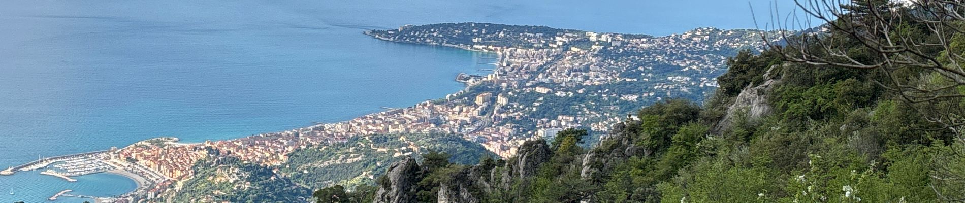
Très beaux paysages avec vues sur la côte de Monaco à Vintimille d'un coté et sur le Mercantour de l'autre.

Elevation profile

Photos

Positioning

Country:
France
Region :
Provence-Alpes-Côte d'Azur
Department/Province :
Maritime Alps
Municipality :
Castellar
Location:
Unknown
Start:(UTM)
379254 ; 4851569 (32T) N.


Close
My subscriptions