


EV et BE MAZERNY

Superpape
User
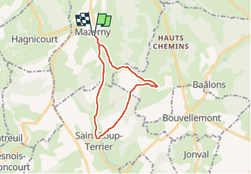

Length
10.8 km

Max alt
246 m

Uphill gradient
192 m
Km-Effort
13.4 km

Min alt
158 m

Downhill gradient
191 m
Boucle
Yes
Creation date :
2025-04-28 13:30:57.044
Updated on :
2025-04-28 17:02:25.703
2h29
Difficulty : Difficult

FREE GPS app for hiking
 SityTrail
IGN / Geographical institutes
SityTrail Plus
The world is yours!
About
Trail Walking of 10.8 km to be discovered at Grand Est, Ardennes, Mazerny. This trail is proposed by Superpape.
Positioning
Country:
France
Region :
Grand Est
Department/Province :
Ardennes
Municipality :
Mazerny
Location:
Unknown
Start:(Dec)
Start:(UTM)
616556 ; 5496448 (31U) N.
Comments