


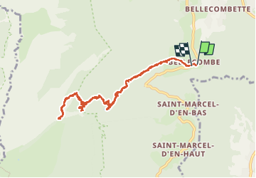
bellecombe porte de l'alpette A/R

Bernard Rodriguez
User

Length
10.4 km

Max alt
1591 m

Uphill gradient
947 m
Km-Effort
23 km

Min alt
693 m

Downhill gradient
946 m
Boucle
Yes
Creation date :
2025-04-10 07:29:38.751
Updated on :
2025-05-06 07:54:47.627
5h45
Difficulty : Difficult

FREE GPS app for hiking
 SityTrail
IGN / Geographical institutes
SityTrail Plus
The world is yours!
About
Trail Walking of 10.4 km to be discovered at Auvergne-Rhône-Alpes, Isère, Chapareillan. This trail is proposed by Bernard Rodriguez.
Description
départ parking à la hauteur de la place de l'église
Positioning
Country:
France
Region :
Auvergne-Rhône-Alpes
Department/Province :
Isère
Municipality :
Chapareillan
Location:
Unknown
Start:(Dec)
Start:(UTM)
731985 ; 5038205 (31T) N.
Comments