


cirque des Monges le 01 05 2025

bymarc26
User
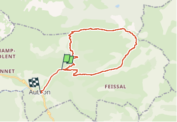

Length
17 km

Max alt
2110 m

Uphill gradient
953 m
Km-Effort
30 km

Min alt
1129 m

Downhill gradient
1032 m
Boucle
No
Creation date :
2025-05-01 06:59:47.046
Updated on :
2025-05-01 14:23:24.066
5h00
Difficulty : Difficult

FREE GPS app for hiking
 SityTrail
IGN / Geographical institutes
SityTrail Plus
The world is yours!
About
Trail Walking of 17 km to be discovered at Provence-Alpes-Côte d'Azur, Alpes-de-Haute-Provence, Authon. This trail is proposed by bymarc26.
Description
il faudra ôter 2,3km car j'ai oublié d’arrêter le GPS où j’avais garé la voiture.
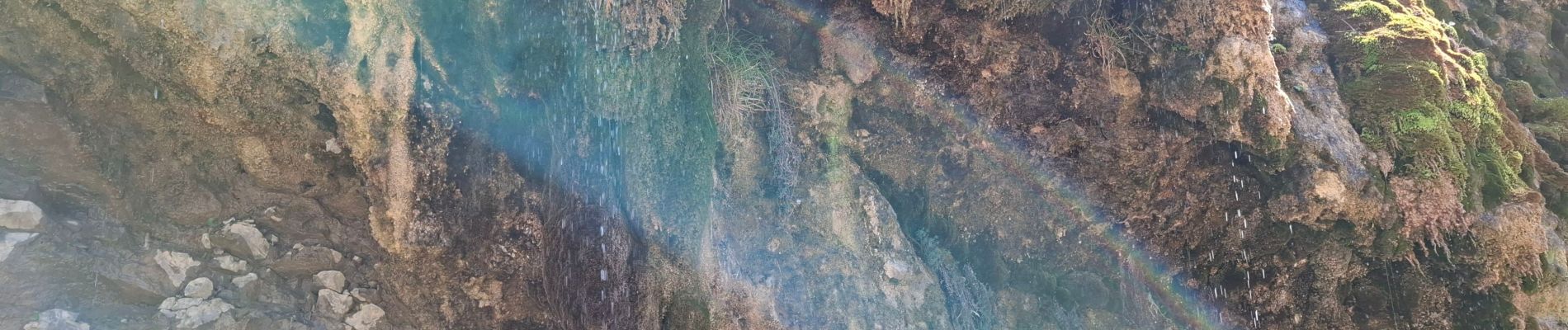
Magnifique randonnée. En crête une grande partie du temps. Vues sur les Écrins le Dévoluy etc...
Photos


Positioning
Country:
France
Region :
Provence-Alpes-Côte d'Azur
Department/Province :
Alpes-de-Haute-Provence
Municipality :
Authon
Location:
Unknown
Start:(Dec)
Start:(UTM)
271842 ; 4903531 (32T) N.
Comments