Trail Walking Saint-Laurent-du-Pont - 010525 boucle Col des Charmilles par le Pas de Biche - Photo

010525 boucle Col des Charmilles par le Pas de Biche

© OpenStreetMap contributors
Length
Length
21 km
Max alt
Max alt
1658 m
Uphill gradient
Uphill gradient
1300 m
Km-Effort
Km-Effort  
39 km
Min alt
Min alt
865 m
Downhill gradient
Downhill gradient
1290 m
Boucle
Boucle
Yes
Creation date :
2025-05-01 06:07:06.297
Updated on :
2025-05-01 19:57:08.801

(0 Reviews)

Walking
Walking
8h00
Difficulty : Very difficult

Scan this QR Code to open this trail in the SityTrail application

FREE GPS app for hiking

Logo SityTrail SityTrail

IGN / Geographical institutes

Download SityTrail from the App Store Download SityTrail from Google Play

Logo SityTrail SityTrail Plus

The world is yours!

Download SityTrail from the App Store Download SityTrail from Google Play Download SityTrail on Huawei AppGallery

About

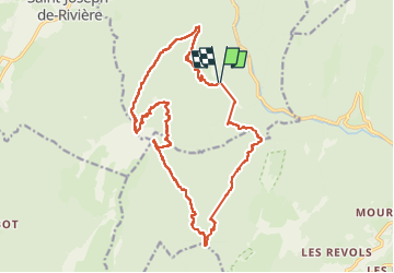
Trail Walking of 21 km to be discovered at Auvergne-Rhône-Alpes, Isère, Saint-Laurent-du-Pont. This trail is proposed by mzonzon05.

Description

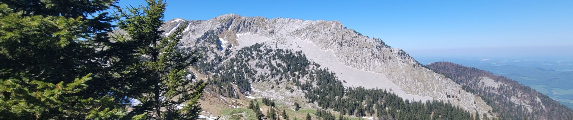
magnifique boucle très variée (sous-bois, balcons et alpage) merveilleux en ce jour de printemps car les jonquilles forment de véritables tapis par endroit et l’on a pu ramasser de l’ail des ours pour l’année !
Une variante un peu plis courte consisterait à descendre par le chemin de Tenaison peut-être plus agréable que le Chemin de None.

Elevation profile

Photos

Positioning

Country:
France
Region :
Auvergne-Rhône-Alpes
Department/Province :
Isère
Municipality :
Saint-Laurent-du-Pont
Location:
Unknown
Start:(UTM)
714972 ; 5026385 (31T) N.


Close
My subscriptions