


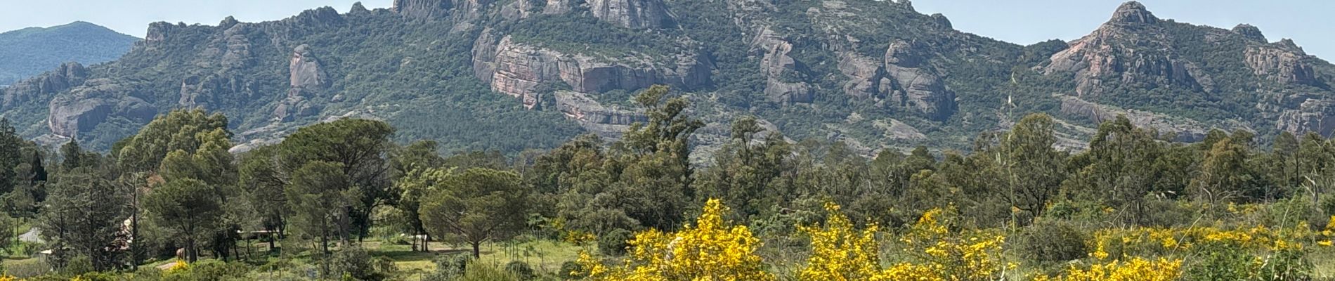
Roquebrune - MF de Palaison

GeorgesV.
User
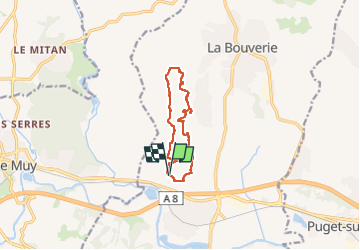

Length
9.8 km

Max alt
84 m

Uphill gradient
131 m
Km-Effort
11.6 km

Min alt
26 m

Downhill gradient
131 m
Boucle
Yes
Creation date :
2025-05-02 06:28:07.0
Updated on :
2025-05-02 09:30:01.873
3h01
Difficulty : Easy

FREE GPS app for hiking
 SityTrail
IGN / Geographical institutes
SityTrail Plus
The world is yours!
About
Trail Walking of 9.8 km to be discovered at Provence-Alpes-Côte d'Azur, Var, Roquebrune-sur-Argens. This trail is proposed by GeorgesV..
Photos


Positioning
Country:
France
Region :
Provence-Alpes-Côte d'Azur
Department/Province :
Var
Municipality :
Roquebrune-sur-Argens
Location:
Unknown
Start:(Dec)
Start:(UTM)
307436 ; 4815638 (32T) N.
Comments