


1 er mai

francisdean
User
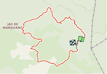

Length
12.1 km

Max alt
785 m

Uphill gradient
312 m
Km-Effort
16.2 km

Min alt
604 m

Downhill gradient
308 m
Boucle
Yes
Creation date :
2025-05-01 08:35:33.574
Updated on :
2025-05-02 13:41:54.111
6h20
Difficulty : Easy

FREE GPS app for hiking
 SityTrail
IGN / Geographical institutes
SityTrail Plus
The world is yours!
About
Trail Walking of 12.1 km to be discovered at Provence-Alpes-Côte d'Azur, Var, Signes. This trail is proposed by francisdean.
Positioning
Country:
France
Region :
Provence-Alpes-Côte d'Azur
Department/Province :
Var
Municipality :
Signes
Location:
Unknown
Start:(Dec)
Start:(UTM)
737200 ; 4790705 (31T) N.
Comments